


New
 3")
Toponav Maps and software Quebec’s Topographical Cards (SD)
Original price was: $99.95.$79.96Current price is: $79.96.
- Efficient and effective customer service, online.
- Shop with Confidence
- No Compromise on Quality
- Quality You Can Trust

- Model: 1311.
- On a microSD/SD card.
- Compatible with Basecamp software for computer consultation.
- Quebec’s Topographical Card.
- Based on the official data of Ministère de l’Énergie et des Ressources naturelles du Québec.
- 1/20 000 scale.
- Forest roads network.
- Snowmobile, mountain bike, pedestrian and canoe trails.
- Public/private delimitation.
- 3D, ideal for any outdoor activity.
Please note that there is no exchange or reimbursement for this product.
Be the first to review “Toponav Maps and software Quebec’s Topographical Cards (SD)”
Related products
New
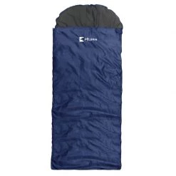
Original price was: $59.95.$41.37Current price is: $41.37.
New
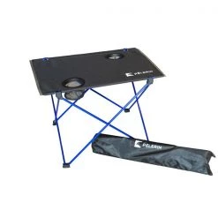
Camping tables
Original price was: $29.95.$25.46Current price is: $25.46.
New
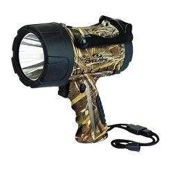
Lamps and lighting
Original price was: $49.95.$39.96Current price is: $39.96.
New
Camping accessories
Original price was: $19.95.$12.97Current price is: $12.97.
New

Original price was: $272.96.$96.99Current price is: $96.99.
New
Original price was: $24.95.$18.71Current price is: $18.71.
New
Outdoors
Original price was: $39.95.$31.16Current price is: $31.16.
New
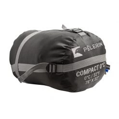
Original price was: $99.95.$72.96Current price is: $72.96.
Reviews
There are no reviews yet.